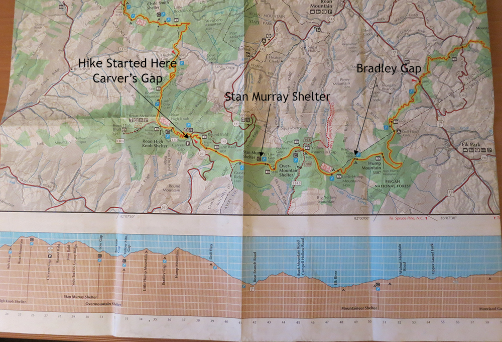
Carver’s Gap Hike July 9 – 12, 2013

Following our successful dry run to Fanning Springs (see previous post), Jeremy and I were ready to head to North Carolina to hike the Carver’s Gap to 19E portion of the Appalachian Trail. Well, not exactly the whole 14.5 miles. We only had three days, so our plan was to start at Carver’s Gap on day one and hike 3.5 miles to Stan Murray Shelter and spend the night. On the following day, we would hike the 5 miles to Bradley Gap, set up camp and then explore the area. Finally, on the third day we would turn around and make the 8.5 mile climb back to Carver’s Gap.
We flew out of Gainesville Tuesday morning, July 9th, at approximately 7:45 AM in the trusty Cessna 172. With only two of us, we had just enough room for all the equipment; minus the stove fuel of course.
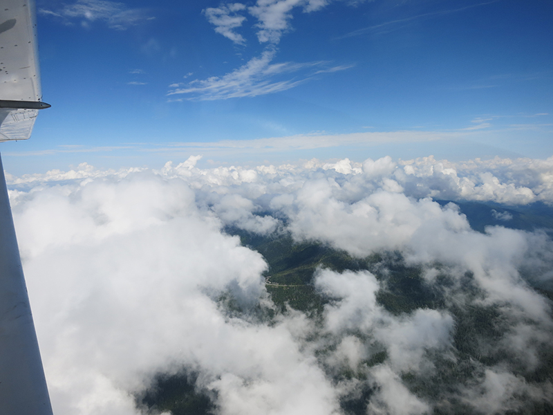
Here we are crossing the North Carolina – Tennessee border. It was a beautiful day! After an uneventful 3.5 hours flight, we landed at the Gatlinburg/Pigeon Forge airport in Tennessee.
You’re probably questioning my navigation skills right about now, thinking, “Isn’t the trail head in North Carolina; so what are they doing in Tennessee?” Good question! We stopped to see my daughter and her family.
After an uneventful evening, we stocked up on the remaining supplies and then drove the rental car 3 hours to Carver’s Gap. It began raining as we approached the trail head (of course) and kept raining for the next two days.
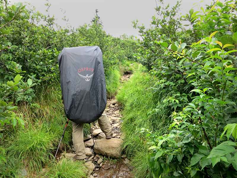
After donning our rain gear and covering the packs, I took a cursory look at the trail map and then promptly headed off in the wrong direction. (Now you can question my navigation skills). About a mile into an already grueling hike I realized the mistake and turned around.
Heading in the correct direction we soon came to Round Bald and began taking pictures in between rain showers. We then passed Jane Bald and took more pictures. From here the rain began falling heavier and we could hear thunder in the distance.
We were very exposed on the balds and had nowhere to go in case of lightning; so we moved post-haste towards our destination.
 .
.
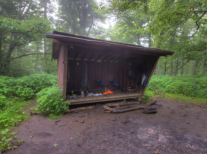
We arrived at the Stan Murray Shelter and discovered no one else out camping that day. Hmm! I wonder why?
We settled under the shelter and began collecting water – both for cooking and drinking. Our SteriPen UV water purifier worked great.
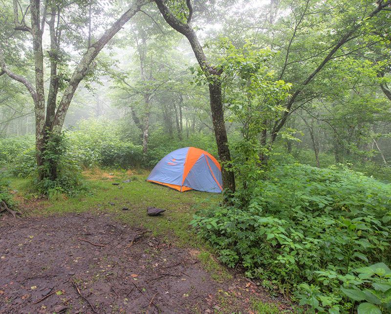
With night rapidly approaching, we set the tent up using it’s rain cover as an interim shelter to keep the interior dry. Properly fed, hydrated, and with our sleeping accommodations arranged, the only remaining chore was to find a suitable tree to hang our food so bears couldn’t get it.
The rain continued through most of the night.
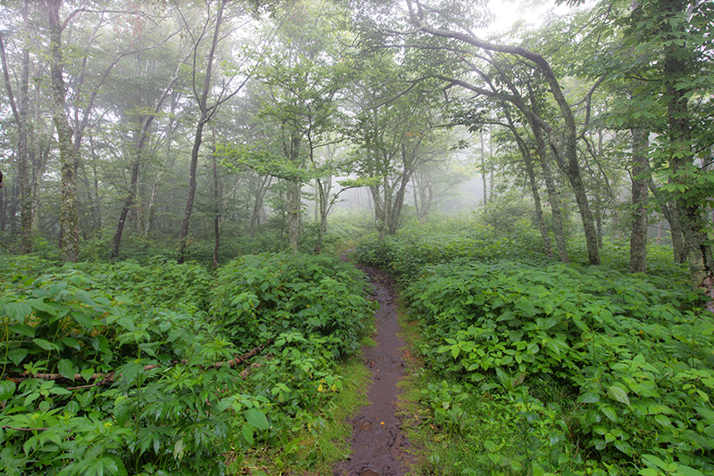
We awoke the next morning to dense fog. After eating breakfast we broke camp and headed for our next destination – Bradley Gap.
The plan was to set up camp at Bradley Gap, then day hike a mile to Hump Mountain to take sunset photos and return to camp later that evening.The rain began falling again as we passed the Overmountain shelter and we decided to review our strategy.
When we first arrived in North Carolina, the weather forecast showed a cold front moving through for the next couple of days. We were hoping the forecast was too pessimistic. However, it looked like the forecast was going to hold and the rain and clouds were definitely inhibiting the opportunity for photographs. Additionally, the forecast for Florida also showed a stationary front stalling at the Florida – Georgia border the day we intended to fly home.
Therefore, we made the decision to head back to Carver’s Gap, retrieve the car, drive back to Sevierville and fly home a day early.
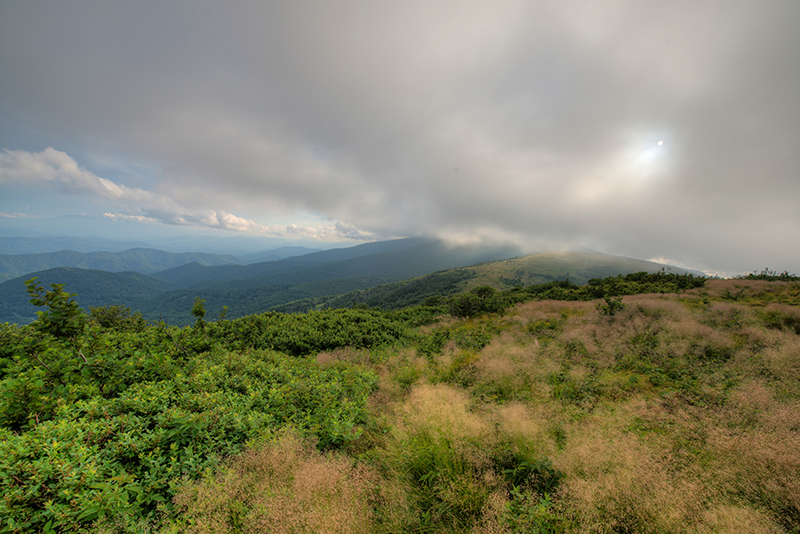
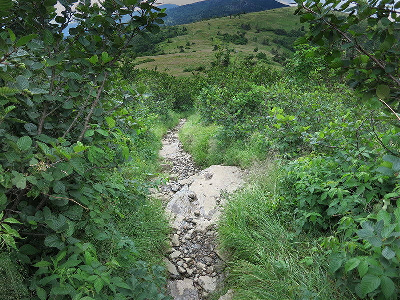
The weather began teasing us as we crossed Jane Bald heading back to Carver’s Gap. This is looking at Round Bald with the Sun peaking through the clouds.
We departed Carvers Gap around 8:30 PM on July 11 and spent the night at Sevierville.
We arrived at an overcast Gatlinburg Airport early July 12 to discover a line of thunderstorms stretching across the Florida – Georgia border. We departed and flew as far south as the weather allowed. Landing in Macon, Georgia, I reevaluated the weather and after a quick lunch decided to fly behind the system to Tallahassee, Florida. Upon refueling, we flew the remaining leg to Gainesville and arrived around 5:15 PM.
Overall, the trip was a success. I was able to take about 50 good HDR photos from Jane and Round bald as well as from our campsite. The equipment worked flawlessly and if the weather had cooperated, I could have captured some beautiful images from the balds and Hump Mountain.
Like to leave a comment? We would love to hear from you. Please leave a comment in the form below!
Hi! What map did you use ? I am currently trying to find one when I use for when I do this hike in a few weeks !
Sorry it took so long to reply; been travelling.
I used a map in a book by Joe Miller, “Backpacking North Carolina”.